
Burton ZIP Code Coverage
The Michigan DTMB ZIP map labels three ZIPs in the Burton area: 48509, 48519, and 48529. It also says ZIP boundaries are approximate. That qualification is central to a Burton ZIP code search. The map gives regional context, while the exact street address is the test for delivery assignment. The research did not establish a complete street list, a complete counter list, or a ZIP-specific population table for any of the three areas.
| ZIP | Areas Covered | Post Office | Notes |
|---|---|---|---|
| 48509 | Burton area shown on the Michigan map; exact street edges require USPS lookup | Exact delivery assignment requires USPS address lookup | Approximate map coverage, not a city-boundary line |
| 48519 | Burton area including City Hall and the Assessor at 4303 S Center Road | Burton, MI 48519 delivery-distribution unit routing is documented | Exact coverage remains address-level |
| 48529 | Burton area shown on the Michigan map | Current station or counter detail was not identified in the research | Use exact address lookup; no complete street list was found |
Postal Bulletin material routes 48439, 48519, and 48529 to the Burton, MI 48519 delivery-distribution unit. That is a routing clue only. It does not make 48439 a Burton ZIP and it does not replace an address lookup. A ZCTA can also be helpful for statistics or map work, but a Census ZCTA is not a USPS delivery boundary.
Burton ZIP Geography Needs an Address
Keep the source form of a street name and a separate normalized form for searching. Preserve directional prefixes and suffixes, road-type abbreviations, unit identifiers, and old or alternate spellings. When the same number appears in nearby communities, check Burton and Flint separately. The city directly adjoins Flint and meets Genesee, Davison, Grand Blanc, and Flint townships, so a Burton mailing label can sit beside a different municipal or historical jurisdiction.
For a parcel at the edge of a ZIP area, use the tax map and legal description as well as the delivery result. A situs address identifies the mapped parcel. A mailing address is a tax-bill or contact destination. They can differ, and neither field alone establishes where someone physically lives. The same care applies to a directory entry, a voter registration address, a permit location, or a deed description.
Note: Retain the source jurisdiction and date whenever a record says Burton near a city or township edge.
USPS Checks for Burton ZIP Codes
The USPS ZIP Code Lookup is the delivery authority for a specific address. Use the city and state screen only as an initial check, then use the full address when a street lies near a boundary or when a record has competing labels. The tool's live result controls delivery assignment more closely than a regional map. It does not tell which parcels are in Burton city, which township administered an older record, or which people are connected to a ZIP.
USPS address lookup is shown here because its result is the proper way to confirm a Burton ZIP code for one complete delivery address.
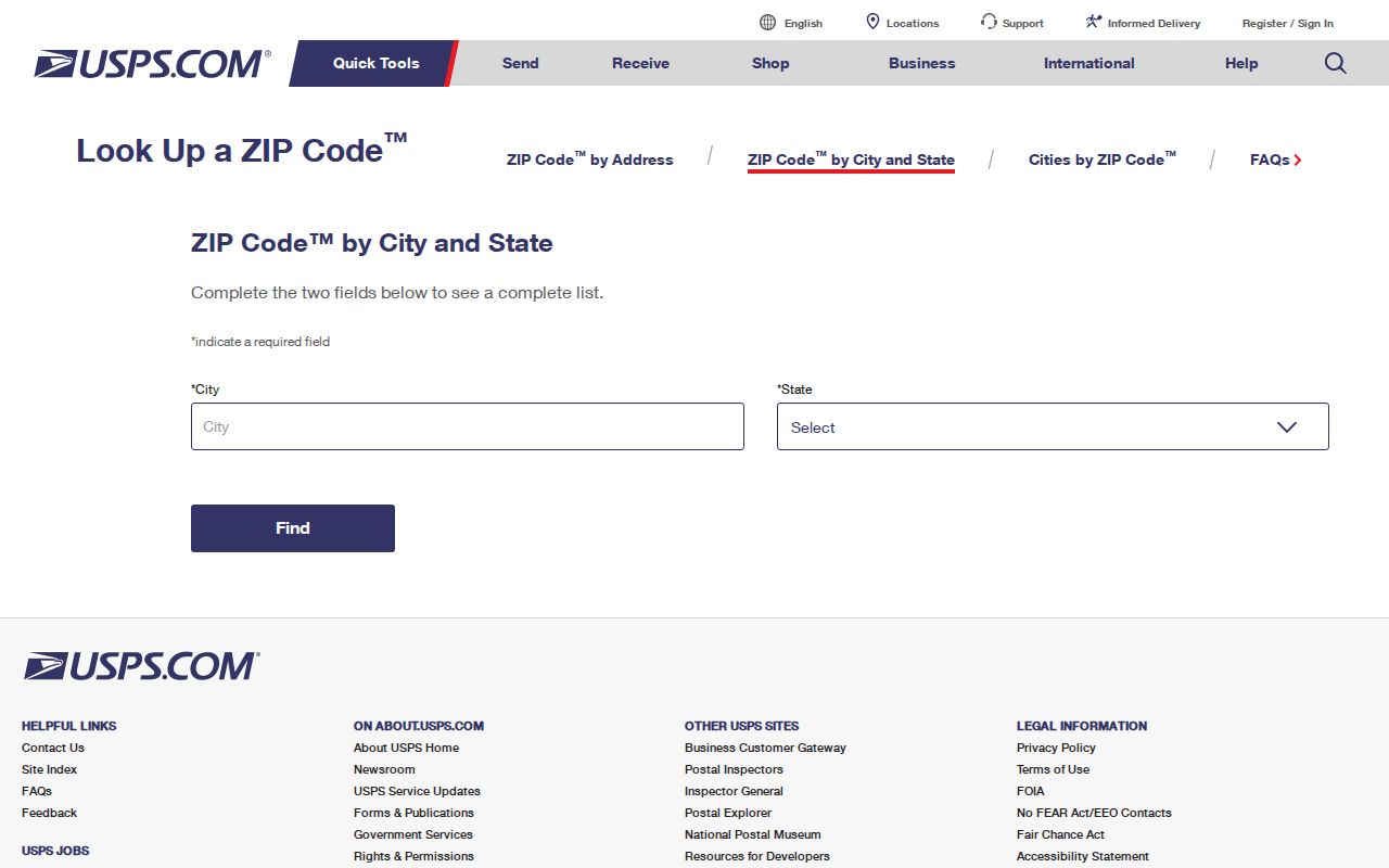
After USPS returns a delivery result, retain the standardized address and ZIP with the date checked. Then compare the parcel's situs, tax-map identity, and municipality rather than carrying the ZIP result into a broader claim.
- Enter the complete street address, city, state, and any unit in USPS lookup.
- Save the delivery ZIP returned for that address and preserve the standardized street form.
- Use the DTMB map only to understand approximate regional coverage for 48509, 48519, or 48529.
- Match the result to a parcel or dated record only after checking its jurisdiction and address fields.
Burton Parcel Search Modes
ZIP entry is not a documented way to obtain a complete Burton parcel or resident result set. The local portals are address- and parcel-oriented instead. Burton BS&A and the Genesee Parcel History viewer can help after an exact address has been checked. Parcel History documents Tax Map Number, Deed Info, Owner Name, and Address modes, along with a municipality selector and exact-match or top-100 controls. It should not be presented as a ZIP-wide search.
| Parcel History mode | Use after an address match | Fields to retain |
|---|---|---|
| Tax Map Number | Copy the identifier exactly, including hyphens, leading zeroes, and municipality prefix. | Tax map, situs, owner or taxpayer label, and deed reference if shown. |
| Deed Info | Use a known deed reference to connect a selected parcel to instrument information. | Deed reference, dates, owner history, and parcel relationship. |
| Owner Name | Narrow a named record with the municipality selector and live exact-match controls. | Owner or taxpayer label, parcel, situs, mailing address, and update date. |
| Address | Use the standardized street form, with road type and direction retained. | Situs, parcel, legal description, map link, and available value fields. |
The Genesee Parcel History viewer is updated weekly and reports ownership history and deed references, but older instruments still need a Register of Deeds cross-check. Results are public-record leads, not a statement of current physical occupancy.
ZIP+4 and Other Burton Terms
Postal and parcel terms solve different problems. Use a delivery ZIP to check mail assignment and a parcel identifier to connect mapped land, tax records, and deeds. A legal description may use a subdivision, lot, block, section, or metes-and-bounds wording instead of a street number. Reconciling those keys before attaching a historical name to an address prevents a close-looking match from becoming an unsupported one.
- ZIP Code
- A USPS delivery-area code used with an address; it is not a municipal boundary.
- ZIP+4
- An added four-digit delivery detail that refines a ZIP Code for a particular address or delivery segment.
- PO-box ZIP
- A delivery label used for post-office boxes, which should not be assumed to describe nearby street delivery.
- Unique ZIP
- A ZIP assigned to a particular organization or destination; the research did not identify one for Burton.
- Carrier route
- A postal delivery grouping that is different from a parcel boundary, city limit, or household roster.
Burton Boundaries and ZIP Labels
Burton is an incorporated Genesee County city immediately east of Flint, but its ZIP labels do not draw its government boundary. A city line, mailing city, tax jurisdiction, voting precinct, and delivery ZIP can each follow a different system. The exact address, parcel geometry, and dated source label matter most where Burton meets Flint or the surrounding townships. A record with a Burton mailing city alone cannot settle incorporation, municipal service responsibility, taxation, or precinct assignment.
The practical authority chain is the city Planning or Clerk office for a municipal addressing question, county GIS for parcel geometry and tax-map identity, and USPS for delivery assignment. No authoritative Burton-specific street-numbering manual, ZIP split, or ZIP realignment was captured in the research. For a name or number that appears to have changed, compare plats, city directories, assessor records, deed descriptions, and the Clerk or Planning route instead of assuming a past change.
Burton's 1972 Jurisdiction Shift
Burton's local record story begins with a former township and continues with a city incorporated in 1972. The official financial statement gives April 6, 1972 as the incorporation date, while city-history material uses July 1, 1972 for the effective municipal transition. Keeping both dates helps explain why older material may use Burton Township, Flint, or another nearby geographic label even where a current address is associated with Burton.
Township assessment rolls, poll books, and registers of electors survive in named Archives of Michigan series. They are historical trails organized by year, township, precinct, or record group, not ZIP-based data. The city and township context is more reliable than trying to force an old entry into a modern ZIP code directory.
Limits of Burton ZIP Results
A ZIP, parcel owner label, voter record, or directory listing does not by itself prove current physical residence. The Michigan Secretary of State says registration records are public through FOIA while selected personal fields are not public, and the Qualified Voter File contains more fields than are public. A voter record should therefore be read as a regulated record with coverage limits, not as a complete list for a ZIP or a statement that someone currently occupies an address.
Michigan's Address Confidentiality Program creates another limit: protected voter records are confidential and do not move through the ordinary voter-record process. The driver-record privacy provisions also restrict personal information. Use only information available for lawful personal research, respect protected records, and never use a directory result to harass another person.
Note: A ZIP narrows delivery geography, but it does not create a complete public list of people or households.
From Burton ZIP to a Parcel
Once USPS has confirmed an exact delivery ZIP, continue with the address itself. Burton Assessor material describes a parcel record card with ownership, sales information, and property characteristics. The property information route uses BS&A, while county GIS can show parcel geometry, aerial years, roads, and measurements. For directly adjoining parcels, select the subject parcel first and identify a shared boundary. A nearby point on a map or a matching ZIP does not establish adjacency.
The Burton Assessor property information route and parcel tools are a better next step than a ZIP-wide search. When a delivery area has been narrowed to a street, use the Burton street directory for the address-by-address record sequence. Keep the ZIP check, parcel number, situs, mailing address, and source date as separate notes.